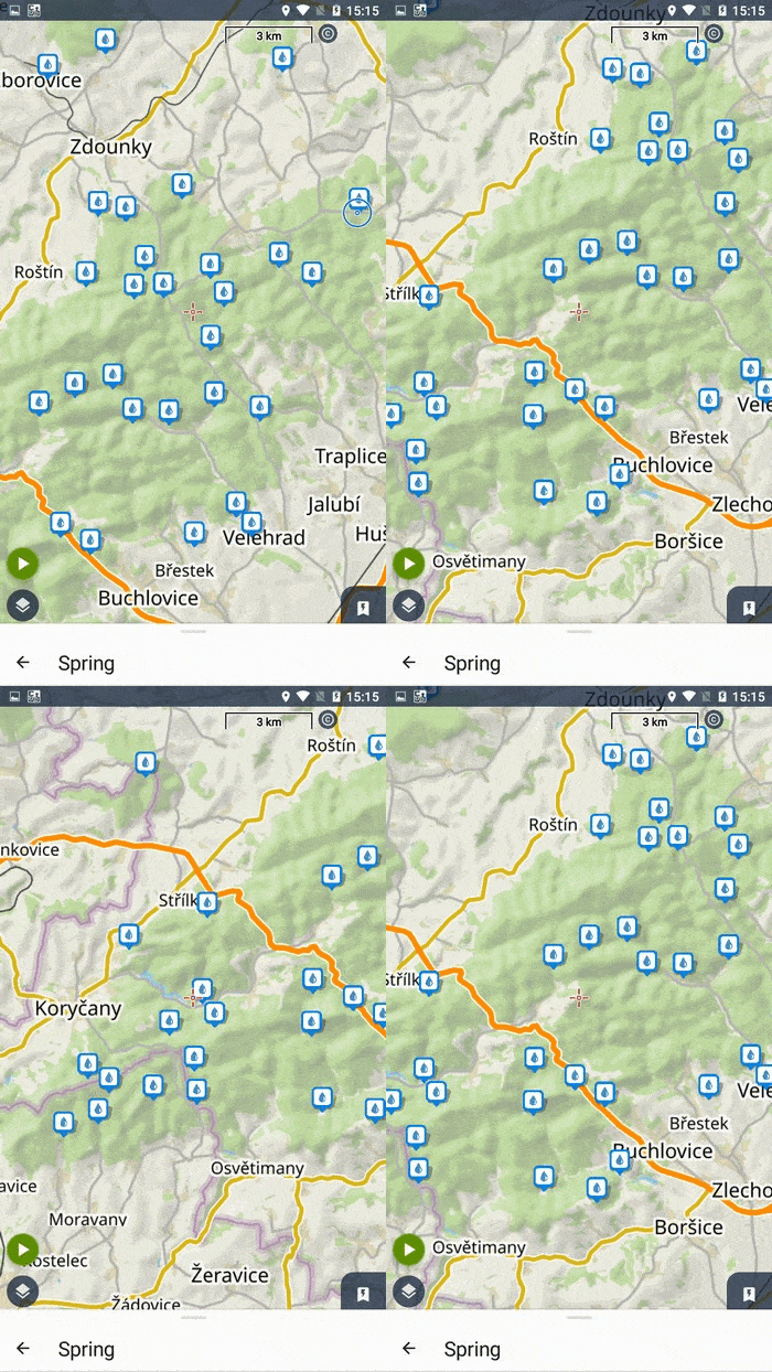
Quite soon after the previous version 4.16, which brought mainly corrections and minor improvements, we are releasing the next version. It is characterized by three main pillars of innovations that required longer-term development – a brand new online search, the next generation of LoMap and a redesign of the colors in the application.
He who seeks will find
In the new Locus, this adage applies several times over – you can quickly search for interesting places, tourist attractions, addresses or entire categories of points of interest. Yeah, you’re thinking, but there’s already an online search in Locus, so what’s changed?
While the original search looked something like the cover image, everything has changed, both inside and out. The new core is our own intelligent search engine, which draws from several databases including our LoPoints. It supports both the Locus Map 4 app and, partially, the web-based route planner. When searching, it takes into account the map being viewed and the importance of the place being searched, offering several levels of search:
Whisperer
Clicking the search button will bring up a predefined list of categories of places that may be most useful to the typical outdoor fan.

So if you’re not looking for a particular place, you can choose from the list. If you’re looking for a category that’s not in the initial list, type it into the search box, and the Locus whisperer will offer it to you in a flash. Tap on a category and all the places in it will be highlighted on the map. As you scroll the map, the next points in the category will load:

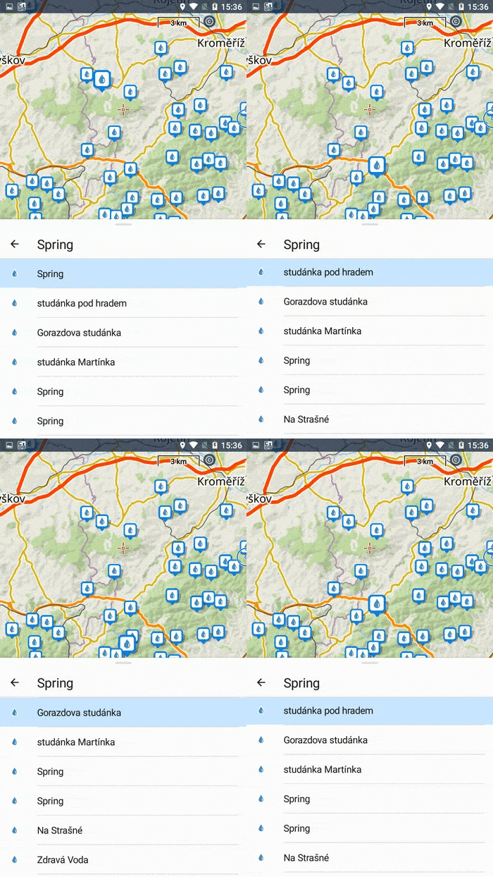
In the bottom panel, the locations are sorted in a list that you can slide out to the full page and browse locations by name. The first item at the top is highlighted on the map:

If you’re looking for a specific place or address, start typing your query in the search box. As soon as you enter the first letters of your query, Locus already suggests relevant categories and places you searched for earlier. It tries to guess what you are looking for and continuously offers other options containing the given character string:

The choices are offered until you click on something or until you complete your search query.
Text search
If you don’t make a selection in the autocomplete and click on the magnifying glass below, Locus starts searching according to the specified string, even in areas that the search engine hasn’t offered before.

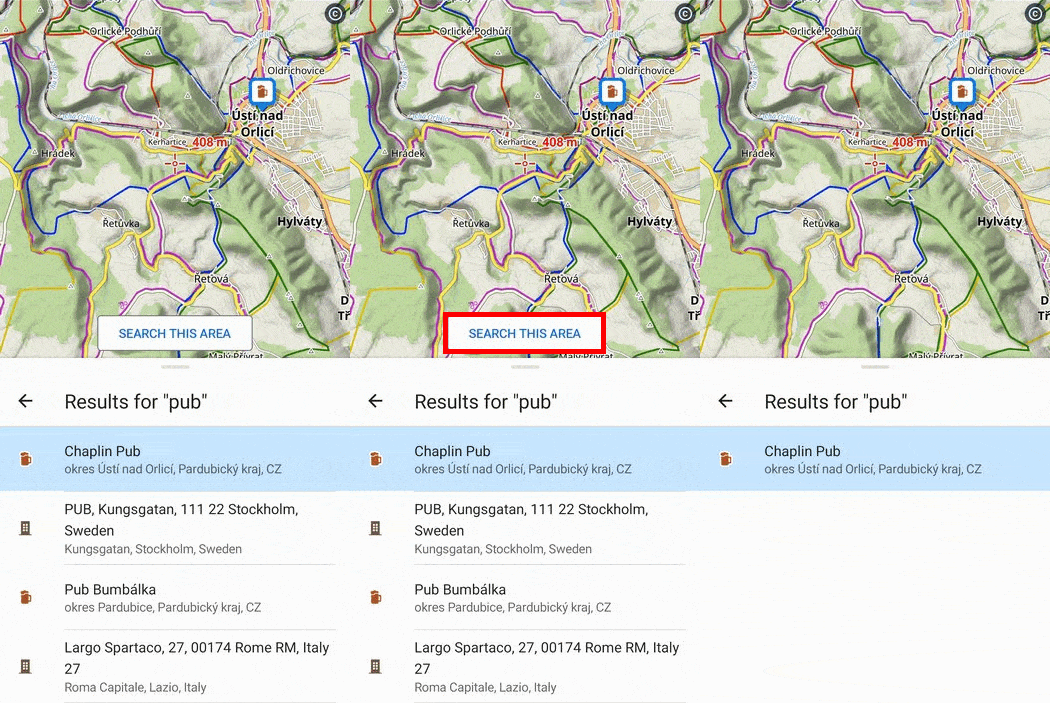
The results are displayed in order of importance and sorted in a list below the map. The panel can be enlarged to full screen and browsed again. You can specify the search area by clicking on “Search this area“:

If you move the map elsewhere or zoom out, you can again change the search area by clicking on the button (the results are not automatically loaded on the map in this case).

So you finally found it…
When you tap on the specific place you found on the map or in the list, the object is centered on the map, and its detailed information is displayed in the panel below the map.

Use the left arrow on the panel to return to the search, or slide the panel down to end the search.
History
Your previously searched queries are offered to you in the whisperer in preference to point categories:

If you no longer use the search items, you can simply delete them from the history.
What about other search methods?
Offline searches for addresses, points of interest, location and other options remain as they are now in the menu you open with the button in the top bar. They will be gradually updated and integrated with the new user interface later on.
Offline LoMaps in the new generation
Our offline maps have also undergone major improvements, resulting from a new implementation of their rendering in the application. We won’t bore you here with technical details that even the writer of this article doesn’t understand, but let’s summarize all the positives that this change brings:
In the Czech and Slovak Republics, we use a unique color marking of hiking trails. The new LoMaps can finally draw them correctly in parallel lines, and they can also handle multiple color combinations:

The unique symbols that mark some trails have also been improved and there are more of them on the map. Trail names can also be plotted:

Some trails, especially in high mountain areas, have parameters to show their difficulty (sac_scale). LoMaps show them in three grades – solid line for the easiest, dashed line for the medium and small dashed line for the hardest:

The winter theme brings better legibility of cross-country skiing trails, skitour and sled trails have been added, as well as names of ski slopes.

The new version of LoMap also fixes a long-standing bug with the names of towns and villages. Finally, their sizes and display are correctly prioritized and longer names are correctly wrapped. Last but not least, the new LoMaps are much richer in LoPoints, of which we have added several categories.
You can recognize the new LoMaps in the Map Manager at a glance by the “V4” label on the icon:

Warning:
Unfortunately, automatic loading does not work between the original V3 and the new V4 LoMaps, so if you get from one version of LoMap to another, you need to activate it manually. Of course, the autoload works between maps of the same generation, so once you update all your LoMaps, everything is fine again.
New colors!
Probably the most obvious change you’ll notice right after the app launches. You’ll be greeted by the light sky blue we’ve applied to the header of all screens. On the other hand, we said goodbye to red, which was highlighting some buttons too much, and instead, we colored the buttons a rich blue for better visibility. So, even though we’re taking inspiration from Google’s latest recommended Material Design standards for this makeover, it’s also partly a return to the original color scheme for us.


32 Comments
Excellent app
Thank you for your outstanding work!
I've got a problem. I tried updating the map of my country bying lucoins It appears that the transaction was approved and that I paid that money from my bank account, but in the app I'm "pennyless". What should I do?
Hi Mirela, please contact our helpdesk at help.locusmap.eu and send your Locus Account address. We'll check it out.
Jo paráda. Ještě kdyby po pridrzeni prstů aby to napsalo i okres kromě kraje. Diky.
Dobrý den, pokud máte zájem o vylepšení aplikace, umístěte svůj nápad na help.locusmap.eu a nechte o něm hlasovat ostatní uživatele. Pokud váš příspěvek získá širokou podporu, budeme uvažovat o jeho implementaci.
I am missing one search function, especially usefull for long distance and thru-hiking. Limit search to points around defined route and in my direction. Example : search for campsites on my route in my direction (not behind me) in a 5km corridor around my route.
Hi, searching POIs along a route is definitely on our roadplan but it'll take a few more months before we can get to it.
I just updated the app. I can see in Map Manager that I have The Netherlands Complete V3 offline Lomap, but in the Locus Store the Map Versions are not displayed, so in the Locus Store it is unknown/unlisted which version of the map is available. So no way to check if an update purchased with Locoins will get me a V4 map of a certain Country/Region.
I checked both The Netherlands and Czech Republic (As CZ was here above announced as a country that had the new V4 Lomaps available) but for neither a map V3 or V4 version is displayed in the Locus Store.
All LoMaps in Locus Store are V4 at the moment.
👍
Looks like Locus is becoming my FAVOURITE hiking app! I am happy with my subscription.
Keep up the good work, guys!
Telefon cserénél vagy factory resetnél nincs mód a túrák mentésére. Elvesznek az adatok. Inkább a mi fit app-ot használom.
Hi, when you set automatic backup to a cloud or turn on automatic synchronization you won't lose your data. See https://www.locusmap.app/backup-or-sync-both/
Just bought a LO map few weeks ago. I should have waited for v4, or do I get the v4 version for free ?
Hi, we offer three various LoMaps for free to the newcomers. Premium Gold subscribers have ALL LoMaps including updates for free. In other cases, the updates are offered for a symbolic price covering costs for the map data rendering, designing and storage.
This is the best application to all my outdoor activities. I recommend it highly to all my friends. Keep up this excellent development and thanks.
The previous version of the maps showed more streets at a given zoom.
photos.app.goo.gl / BUS36wiySudjAJmg6
Hi Maciej, the Google album seems to be empty. Send the coordinates and number of zoom. Thanks
Bei den V3 LoMaps wird Zoom 17 und 100% auf meinem Smartphone mit Zoom 17 angezeigt (Zoom Anzeige Dashboard). Bei den V4 LoMaps wird Zoom 17 und 100% auf meinem Smartphone mit Zoom 19 angezeigt (Zoom Anzeige Dashboard). Und somit nur ein kleiner Kartenbereich dargestellt. Wie kann ich dies ändern.
Hi Gerhard, the app works with the maps so that the ratio and map crop is preserved across all used maps. The zoom level and percents are secondary markers and, to be honest, a bit obsolete. The principle is to see the same map scale and area whether you use LoMap online, offline or any other third party map. If you see a smaller area, just zoom the map out.
Hallo Michal, danke für die Antwort. Mein Problem ist, dass durch das Herauszoomen die LoPoint Online nicht mehr angezeigt werden (viele kommen erst ab Zoom 17).Ich werde versuchen mit der neuen Suche meine LoPoint zu finden, diese werden dann unabhängig von der Zoomstufen angezeigt.
Is there an IOS version available thru the Apple Store? I tried a search for local addresses in Canada but nothing was found
Hi Peter, unfortunately, not. The iOS version is still in development.
Hello,
a couple of questions about Slovenia region:
1. Why does Locus not display hiking route names other than the major ones (such as Via Alpina)?
2. Why is the color scheme of these routes not as per the color tag indicated in OSM?
3. Why is SAC scale of these hiking routes not visible? Or am I missing something?
4. Why can one not look up a peak (summit) by its alternative name(s)?
Thanks
Hi, what maps do you use? If LoMaps, what version? Online or offline?
Hi,
Just the web version of Locus.
Regards
Hi, I've moved your request to our helpdesk at help.locusmap.eu so the conversation continues there. We need some examples and screenshots of the problematic places.
The locus map is not supported on grmin 7x pro, is there an update time?
It is not so generous that you removed the dashboard and made it part of Gold. I was very lucky with my own dashboard and I miss it.
Hi, dashboards are available in Premium Silver, not only in Gold. And, of course, in the good old Locus Map 3 Classic.