A month has passed and we are releasing another version of Locus Map – 3.27. Last time we introduced a brand new Route planner and now we’ve made this tool even better. And also you can enhance style of your tracks and routes in a new improved style editor.
Calamities in the forest? Tell Route planner to avoid it!
Recently we had great winds here in Europe that caused a lot of calamities in forests. Neither maps nor navigation services reflect this situation. But you can help yourself – pinpoint affected areas on map. Route planner will automatically avoid the places when drawing the route.
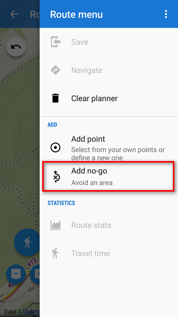
- No-go area button is in Route menu:
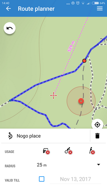
- No-go areas are placed on the position of map cursor
- after tapping the inserted no-go area you can change its radius, type and time of validity:
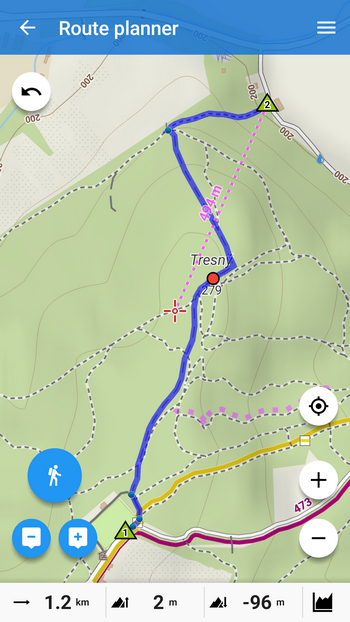
- route without no-go areas
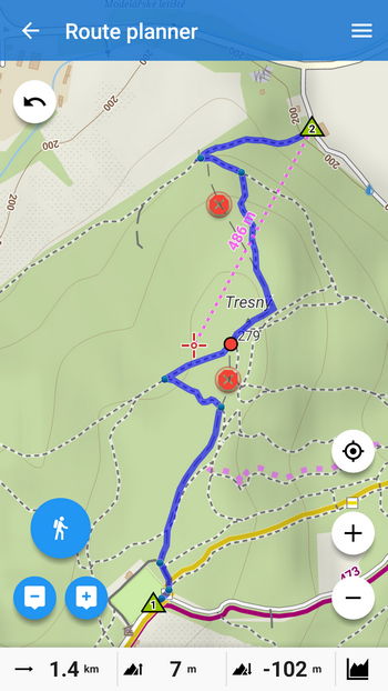
- route with no-go areas
Unexpected obstacle ahead? Mark it and create a detour!
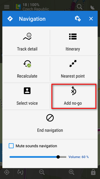
Imagine the situation – you’re riding your bike along a forest trail when you get to a place barricaded with fallen trees. You just can’t get through even with the bike on your back. An ordinary navigation would keep heading you forward – not Locus! Tell it there’s a no-go area ahead and let router recalculate your way:
- start navigation
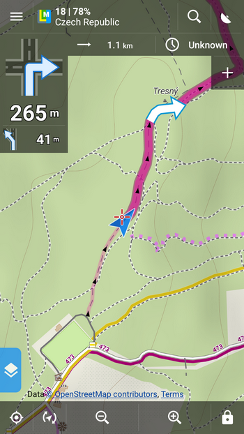
- move map cursor at the affected area
- tap Add no-go in the navigation menu
- a detour is created
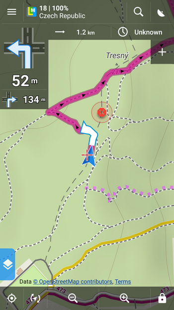
- Great! You’re out of it!
Style your track lines like a fashion designer!
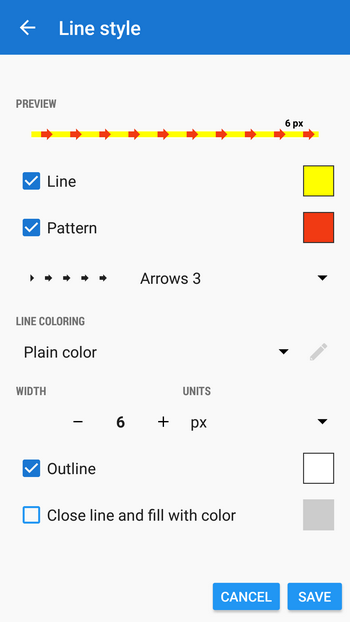
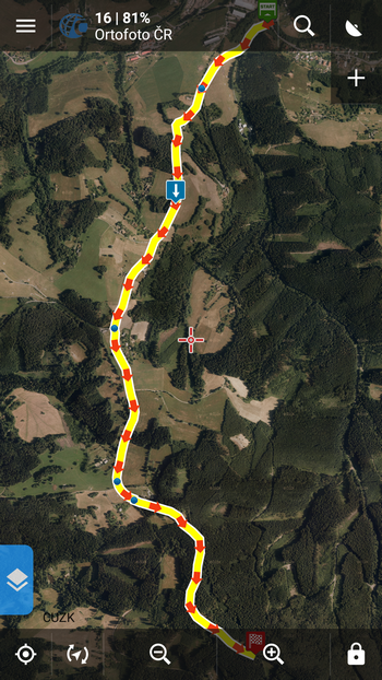
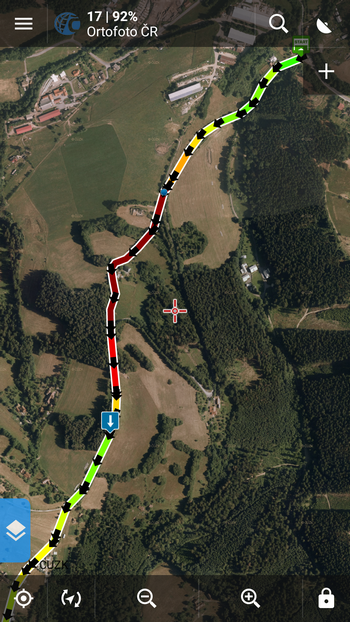
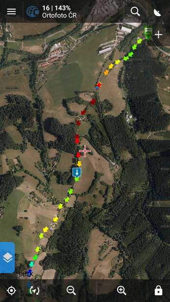
Track/route line color, thickness, outline, pattern, mode of coloring… all these can be set in a new compact editor now, centered for the whole application on all levels – default track style, folder track style, track recorder style, route planner style… all lines can be edited in this single place now in myriads of combinations. Now it’s up to your taste and preferences – you can differentiate your hiking routes, bike tracks or running workouts as you like. Check a few examples:
- line color + red arrow pattern + white outline for a distinct route in the woods:
- slope line coloring + black arrow pattern to display direction and steepness of the route – great for MTB
- no line + slope pattern coloring as an alternative of the design above
- the line can be patterned in many ways:
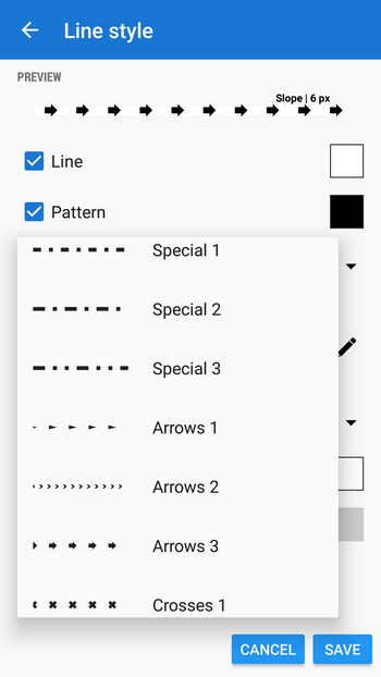
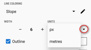
- width can be defined both in pixels or in meters
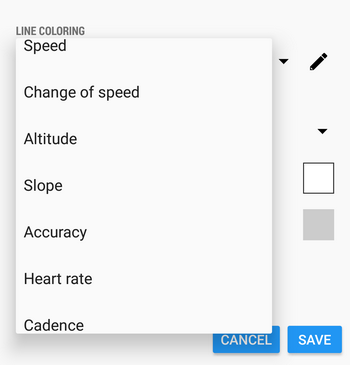
- wide selection of coloring modes is available
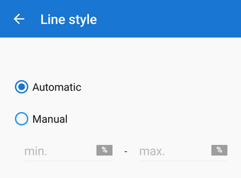
- slope and altitude coloring mode limits can be set individually
We hope you’ll enjoy all these improvements on your trips now or later in winter. Mountains are getting snow capped and slowly it’s about time to check your winter gear!
Locus MapLocus Map Pronew releaseroute plannertrack line style

6 Comments
Is it possible to customize offline vector maps with locus?
Hi,
it is possible to customize LoMaps - Locus- based vector maps. See https://docs.locusmap.eu/doku.php?id=manual:advanced:map_tools:theming
Thanks for realisation of these options.
Especially the track designer is really helpful if you use the ascent/descent option with "-"
No more surprises in unknown territory.
Helps to play around with the adjustments
Excellent improvements, thanks you!
Hi, i need to use nogo places in other device i try to use a backup from locus and this places didnt load.
Where can I find to transfer manualy?
Thanks
I found the file.
Locus/cache/varios/nogo_places.lb
Now i can use it in other devices and update