Summer holidays have passed like nothing, autumn is slowly knocking on the door, but the outdoor sports season is far from over. On the contrary, we are all looking forward to walks and rides full of autumn colors. So here we are again with a new version of your favorite outdoor navigation. It is full of major or minor improvements, of which we would like to highlight a few of the most important.
The map rotates, the names and labels remain
You all know how to rotate the map according to the compass or direction of movement, it’s a basic feature of the map in the app. If you have rotation turned on and your phone has a built-in compass, the map rotates according to it, even when you’re standing still. If you don’t have a compass, Locus Map rotates the map in the direction of motion detected by GPS and other sensors. Until now, everything that was part of the map data rotated too, including local names and labels.
By updating some parts of the machine that renders offline vector maps in Locus (LoMaps and OpenAndroMaps, for example), we were able to apply the option to keep the titles in a horizontal position so that they are perfectly readable in any orientation of the phone:
The labels of objects such as streets, hiking or cycling routes are still aligned with their lines, but when flipped over vertically they switch to the other side, again for better readability.
The only labels that do not change their position are the elevations on the contours, as they are always written “top to bottom” to convey the direction of the slope.
Texts in online maps continue to rotate – online maps are technically different, being composed only of raster images in which the text is part of the map layer.
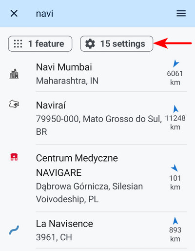
Search 3 in 1
Locus Map’s main plus (and some say minus) is its lavish selection of features and settings. Even many advanced users used to get lost in the plethora. That’s why you can search the functions and settings in full-text – you can find the “magnifying glass” both in the menu of all functions and in the main settings menu.
Now we’ve made this search even more accessible – we’ve linked it to the main online search for places and addresses. So when you enter the first few characters into the general search, toggles appear with results in the functions and settings categories, if Locus Map finds a result for the query.
But the work on the search doesn’t end here – we are preparing a new Library for you, which will include a new search in your routes and places. We’ll also add the results to the main search results list.
Even better planning and navigation
More accurate route time estimation
When planning a trip with the family or a brisk ride with friends, estimating the time spent on the route is always very useful. For example, we still need to catch a visit to grandma’s or we don’t want to return in the dark. However, general estimates of return time do not always correspond to the actual reality, which can be very individual.
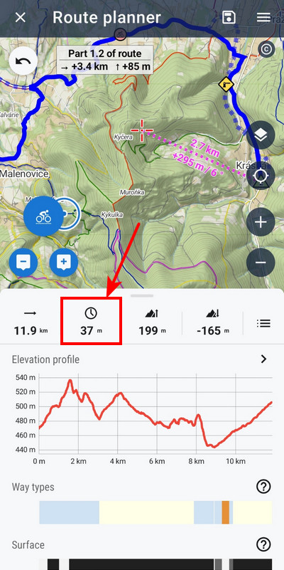
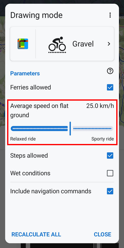
That’s why we’ve added to the LoRouter profile settings the ability to define a custom average speed on a flat surface, typical for a given activity or bike type. This allows Locus Map to calculate a much more accurate estimate of how long you will be on the route. We’ve added this option to both walking profiles and to all bike types except road bike – road cyclists have a setting based on wattage, which our research shows they track more.
The setting ranges vary by activity type. So, for example, for walking you can set a time corresponding to a relaxing walk to a fitness run, for gravel you can choose between relaxed and sporty riding, etc.
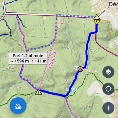
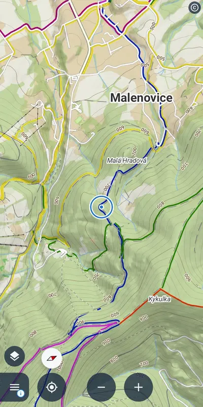
Two routes at once, why not?
Until now, you have only been able to generate alternate routes using the GraphHopper online router. Now our offline LoRouter can do this without needing to be connected to the internet, and offers many more activity profiles and personal settings. Just turn this option on in the router configuration.
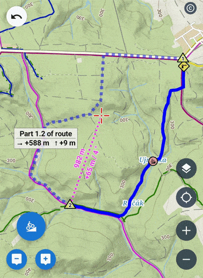
You can easily switch between the options by tapping directly on the map in the planner. Of course, the variations are not just for the complete route, but for segments of it, so you have a little more room to experiment when planning, and very quickly choose the most optimal route for your trip or training.
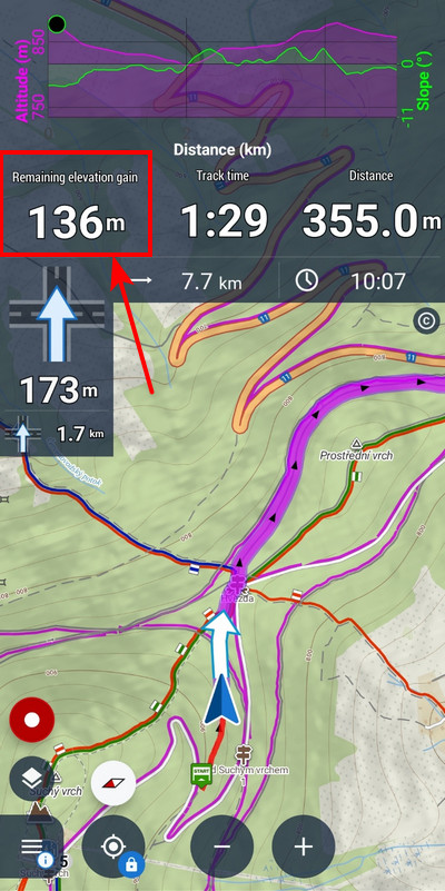
Are we going uphill for a long time?
This intrusive question is familiar to every parent who has ever gone on a bike trip with their kids. However, the remaining elevation figure is also of interest to more sporty riders, who can better distribute their forces according to it. You can now insert it directly into your favorite dashboard that you use for navigation:
Finally, something for Garminers
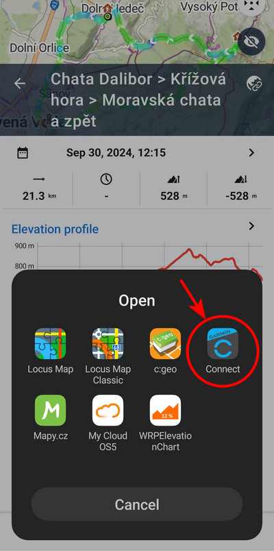
For Garmin smartwatch users, we have a great add-on to quickly get a Locus Map route to the device on your wrist. However, it’s not available for all devices. If you have a Gamin Edge or other device that is not on this list and you want to get routes planned in Locus Map into it, just tap Share > Share as GPX in the route details and then tap “Open”. Garmin Connect is also in the apps menu. Select it, choose an activity on your route, save and sync with your device. And you’re ready to go!


46 Comments
Is map streaming supported again for Garmin? (Venu user)
Hi Martin, unfortunately, this option was disabled by Garmin producer in order to push their own maps and there is no way to restore it.
Super. Miluji Locus. Češi mají super pivo, dále vymyšlené slovo Robot a Locus Map :D. Chci se zeptat, budou i nějaké další vychytávky pro hodinky Garmin? Já osobně měl F7X Pro a nyní nám I2X Solar. Díky.
To jste nám hodně zalichotil, díky! :) Jaké další vychytávky pro Garmin hodinky byste ocenil?
I remember that I could estimate distances by touching the screen with 2 fingers on my locus classic. Why can't I do it anymore? Could it be re-added?
Hi Pierric, the option to measure with two fingers is still available. Check that you have it turned on in settings > controlling > map screen > two fingers measuring.
Will it be possible to modify an existing round trip to change the starting position along the route?
Hi Werner, you can start navigating the round trip anywhere along its route. If you need to replan the route completely, the route planner offers numerous options.
Hi Michal,
When doing the tour I send the GPX to my Garmin Fenix which leads me. If the entry point is not the starting point in the GPX (round trip) I would like to shift the track points along the track so the entry point will become the new starting point. So I want to select this point in the track and perform the action "start track at this position".
Is this already possible?
Werner, this option is available in Locus Map. Tap the place on the route on the map, tap navigation and check the option "Navigate from selected point". Unfortunately, we do not have influence on the way the Garmin Fenix navigates.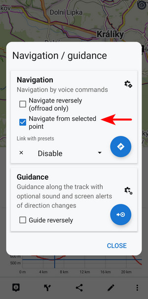
Thanks, Michal.
But with this option you don't create a modified track, right?
I guess that it's not a big effort to program a shift of the track points (for round trips) so the selected point will be the first.
It would be great if you do this - thanks!
We think there is no need to create a new modified route every time you decide to start it from a different place. If you think otherwise, you can place your idea on our helpdesk for other users to vote: https://help.locusmap.eu/topic/add. If your idea gets massive support from others, we'll be happy to implement it.
Zdravím. Mě by jen zajímalo, jak otáčení mapy natvrdo a NATRVALO ZAKAZAT. Při spuštění navigování se to vždycky zapne samo a mě může vzít čert...
Dobrý den, zřejmě máte k navigaci navázánu nějakou předvolbu, jejíž součástí je rotace mapy. Buďto tuto předvolbu odpojte od navigace (https://docs.locusmap.app/doku.php?id=manual:user_guide:functions:navigation:settings#link_with_presets) nebo změňte její konfiguraci (https://docs.locusmap.app/doku.php?id=manual:user_guide:settings:presets).
Who can I speak with to make the Garmin add-on working on latest Garmin watch Fenix 8 Amoled version? It is not yet compatible with the add-on and I would like to have Locus add-on into my watch. Thank you
Hi, compatibility with Fenix 8 devices is in the works and will be out hopefully next week!
Super news ,thank you
Také děkuji. Na zprovoznění komunikace s mými novými Garmin Fenix 8 také netrpělivě čekám.
Hi, you can try to install it already. New version of Garmin addon was released. :)
Superb, especially the text orientation and the alternative route. Great work!
Thanks, Stefan, making our users happy with our product is our only goal :)
Ahojte. Locus je super. No po zmene telefónu na Samsung S24+ import vytvorenej trasy v podobe GPS nefunguje. Dráha nie k dispozícii. Chyba pri načítaní trasy- to je hláška v GARMIN. Písal som im a dal info o telefóne SW a detaily. Zatiaľ bez reakcie. Hodinky Fenix 7X.
Dobrý den Pavle, nedaří se mi bohužel tento váš dotaz na našem helpdesku najít. Mohl bych vás poprosit ho poslat znovu? Budu potřebovat více info k určení možného problému. Zkoušel jste importovat trasy jak z plánovače, tak i zaznamenané a hodinky odmítají otevřít oboje?
Excellent!
Thank you!
Môžete mi popísať nastavenie toho grafu na dashboarde. Nedarí sa mi to tak ako to je na obrázku. Dakujem
Dobrý den,
napište nám prosím na helpdesk, pošleme podrobný návod s obrázky.
Will the diagram with the residual altitude figure in addition to cyclists be introduced for hiking as well?
Hi, the chart is independent on the selected activity. You can use it for hiking as well as any other outdoor activity.
How can I activate it and have it on the screen while the locus map guides me for hiking?
It is a part of a dashboard. You can create your own dashboard or use/edit some ready-made one. More about dashboards: https://docs.locusmap.app/doku.php?id=manual:user_guide:tools:dashboards
How do I insert it into the dashboard?
Create an empty cell in the dashboard > change its source to a navigation chart > adjust the chart properties > save the dashboard. More about dashboards: https://docs.locusmap.app/doku.php?id=manual:user_guide:tools:dashboards
Thanks for the above, but you didn't answer my question.
How do I place a chart on the dashboard?
Create a new dashboard or edit an existing one > create an empty cell in the dashboard > change its source to a navigation chart > adjust the chart properties > save the dashboard. More about creating dashboards: https://docs.locusmap.app/doku.php?id=manual:user_guide:tools:dashboards#creating_a_new_dashboard
You are simply the best. Thank you.
We thank you for your support!
When I use Locus on my Chromebook to plan routes, it would be incredibly helpful if the scroll wheel could zoom in and out on the map. It would also be beneficial if the map overlay popup and WMS layer remained visible while drawing routes, instead of disappearing or offering the option to move them to another part of the screen, such as the right side.
When planning cycling adventures, I often switch from OSM to satellite view or WMS layers to avoid getting stuck in bushes and thickets. These features would significantly enhance my mapping experience!
Hi Vedran, as for the roll-to-zoom - activate it in Locus expert settings (https://docs.locusmap.app/doku.php?id=manual:advanced:customization:config#expert_settings). Map overlays can be quickly turned on/off in the content panel on the right side of the planner- WMS layers controller is not available for technical reasons.
Hello Locus team,
Could you provide the best settings for Locus Map for bike riding?
I am using offline maps for Ukraine with navigation on my Galaxy Watch 6 Classic.
I would like the best settings for offline bike routing on my Galaxy Watch, focusing on optimal map view and directions for offline routes.
I plan the routes before riding, and then I follow them during my ride.
Please recommend the best settings for Locus Map with Galaxy Watch 6.
Thanks.
Hi Sergey,
there are no special settings for smartwatches - the Locus Map Watch addon is just an external monitor of what is going on in the main app running on the phone, nothing more. The only road-cycling features in Locus Map are - advanced road cycling route planning profile and support of Garmin Varia bike radar.
I know it, but can you give me some recomended setting for good and quick work with offline map in navigation mode for bike?
Maybe you can do the post in blog for base settings for bike riding? I am newbie and I would like to have some intructions for the best experience with locus.
I habe ivalide code 400 if I search for Camping.
Hi Chris,
if you have a problem with the app, please contact us at help.lousmap.eu and send a detailed description of your actions leading to the problem and screenshots. Thank you.