After more then month (previous version was released 27.3.2013) is available a new version. Which great news bring and what you may expect? As usually, list of all main news is in welcome screen after first start. Anyway most interesting of them are
Altitude manager

– altitudes in mobile devices is disaster. It’s hard fight where always win in accured measuring and used methods, anyway there is still something you may do. Locus since this version introduce complete Altitude manager that serve single purpose – improve measured altitude.
– you may define offset between measured and real altitude manually or automatically. You may use pressure sensor (if you device has it) to obtain much better values. Locus offers a few ways (also an automatic) how to calibrate the pressure sensor. You may also use offline SRTM elevation data to improve measured data and more. All this may remove huge noises and bring measure altitude closer to real values
Improved system for zoom and speed of vector maps
– when you now zoom in/out with Online or Vector maps, Locus now reuses already loaded map tiles and prepare rescaled background for next level. The result of this is much more use friendly experience during zoom like you already know from web map browsers.
– we improved existing vector maps to next level. Now, mainly on multi-core devices, maps are around 20% faster, mainly at high level. Low level are still little bit slow, but we see it from more optimistic side – there is still something to improve.
Retromap and Ukrainian translation

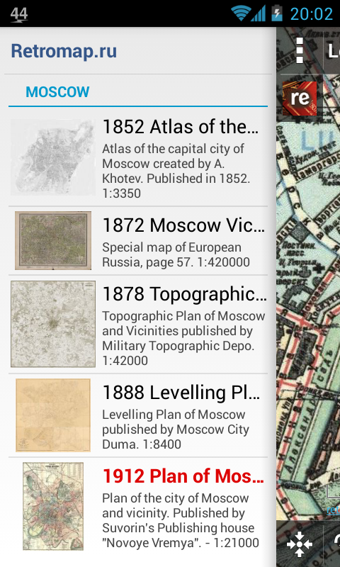
– We’re glad to announce a new amazing maps from Russia Retromap. These maps offer huge range of scanned old historic maps, mainly from an area around Moscow. Currently Locus offers just five of these maps, but if there will be interest, owners are able to offer up to 200 various maps. We suggest to check them, just to see how amazing are old “paper” handmade maps.
– We also have to thanks to user Yaroslav Nalyvajko, who was capable to translate huge Locus (almost 9000 words) in less then three weeks. Thank you Yaroslav for excellent work
Other features
– but there is much more, like ability to define own icons for geocaching (manual), so we hope, you’ll create and share some nice icon pack
– track charts are now less noisy and you may also display gradient of your track
– you may also add vertical speed, slope or current or last GPS time into your dashboards
– we also improved coordinate transformations and added support for Israel, Czech and New Zealand projections
– and these was just news. There is a lot of small changes, many many fixes and more.
Enjoy new version
newsrelease


4 Comments
The prg was fantastic.
The new version wil mlName longer run on. my sytem.
System: surftab breeze 7 from trekstor.
Reason: too small capacity in working intermediate memory.
Prg works ok in Acer B1.
Waiting for your solution.
Kind regards. Friithjof
Hello,
thank you for your comment.
In case of trouble with a new version, please contact us via e-mail support.locus@asamm.com with more information about the problem.
We will be glad to help you.
Thank you in advance
Kind regards
Locus Team
Need help to translate into swedish?
I can help!
/Lennart
Hello Lennart,
thank you for your offer. Sure, we will be glad for your help with translate to swedish!
Is important to know, that translation of the app Locus is voluntary work. In case of your interest, please, contact us via e-mail support.locus@asamm.com
Thank you in advance
Kind regards
Locus Team