The autumn is here, the main season is over. Nevertheless, we haven’t given up our jobs. On the contrary…

During the last weeks and months, we’ve been working on the huge tasks we had set in the spring of this year. At that time, we couldn’t have imagined the amount of work that was awaiting us. Together with some changes in our team, some new colleagues came, some left, the work hasn’t been proceeding as fast as we had expected. Nevertheless, we are moving forward. Slowly, but steadily.
What are we working on now?
There are a few essential projects we are running through. At the moment, if everything goes smoothly, we are planning their release for the next spring/summer season 2020.
Route database
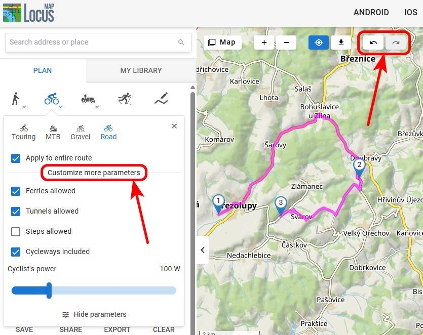
We are building a database of routes that you can use as an inspiration source for your hiking or biking trips. You will be able to select among hundreds or thousands of tips for trips in areas you don’t know or in your neighborhood. In the beginning, the public database will be filled by renowned publishers. Among others, e.g. the German guide publishing house Rother. This database will be available, of course, in our Locus Store.
New design and user interface
Locus Map‘s design has changed a few times but always just slightly. The main UX elements have always stayed almost the same. The reason was, a typical Locus Map user is a conservative person and each alteration going deeper into Locus functionality resulted in many controversial reactions. Nevertheless, building the new Locus Map 4.0, we resolved to make more significant changes. We made some inner surveys, did a few ergonomy analyses and comparations with competitive apps. Recently, we are beginning to see the first results of these efforts (just wait a few more weeks for them :).

What comes in the latest version?
Simultaneously, the “old” Locus Map development is going forward too. Implementing the new map core completely changed the internal app work with the map data. It enabled overlays of various map formats and coord systems, improved legibility of many maps on current full HD screens with automatic resolution optimization.
In this newest Locus Map version, we polished the app UI – we unified details of screens, panels, and colors all over the app. And, we added an option to link app presets to navigation:
Navigate with your favorite app preset automatically
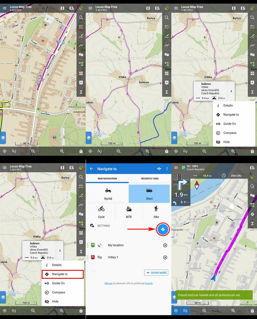
Imagine: you’re sitting in your car setting out to hunt for some caches. You’ve just selected the first treasure box and want to start navigation to it. But, Locus Map is set to your hiking preset – hiking map theme on, cursor centered, display automatic turning off, etc. Never mind, tap the cache on the map, select Navigate to, then choose a car profile and GO. Locus Map resets itself to your car preset – road map theme on, the screen always on, cursor down, map rotation on, hardware compass off, etc. Of course, when you get to your target and the navigation stops, Locus Map re-sets itself back to your original preset. Fast and easy, isn’t it?
How to set it up?
Go to Locus navigation settings > Link to presets. There are three options for the three most common ways of transport – walk, bike and a motor vehicle. Tap Motor vehicle and select an appropriate preset from the list. Do so with the walk and bike as well. Easy peasy. And how it works? See the short video:

Goodbye GPSies!
All of you, who used GPSies.com (a great public route database), have been informed by its provider that the service was merged with Alltrails.com. Unfortunately, this merger means the end of GPSies integration in Locus Map. The new provider isn’t interested in such integration. Understandably, they need to push their own app forward.
As the saying goes, everything bad is good for something. This is another motive and inspiration for us, to put more energy into our own route database project mentioned above. So, keep fingers crossed for us!
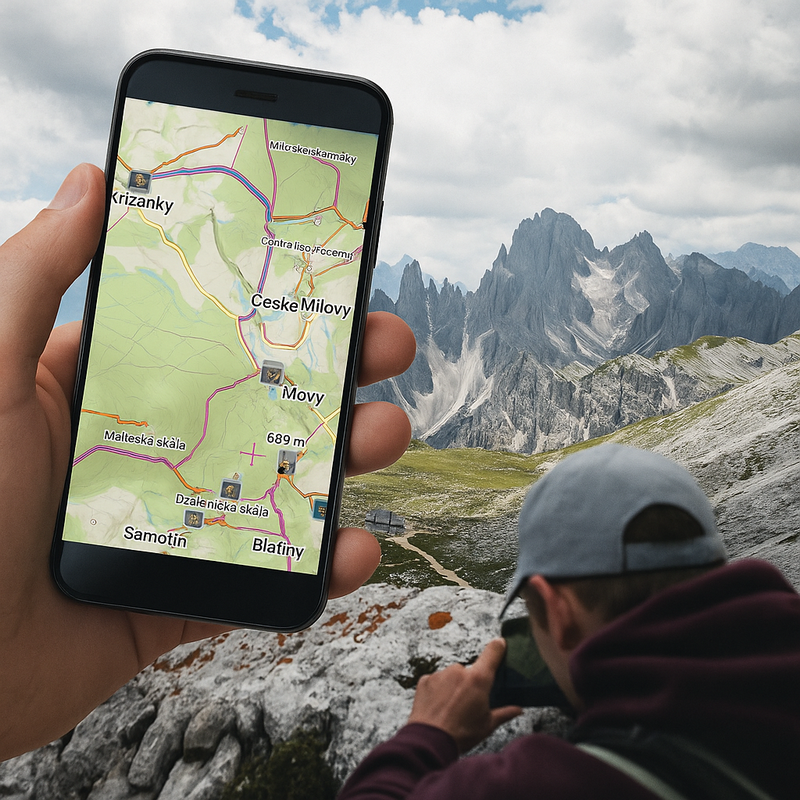
Photos by Wilfried Santer and Helloquence
navigationnew releasePresets


18 Comments
Hallo, ich wünsche euch ein goldenes Händchen für euer Vorhaben. Ich hatte mal ne' super Wetterapp - bis zu einer umfassenden Überarbeitung, dann war sie ein Fall für die Tonne!!! Last Augenmaß walten ...
Alles gute
Der CamBär
Navigieren Sie direkt mit Ihren bevorzugten Vorgaben (Presets):
Diese Neuerungen habe ich direkt getestet und mir ein Profil für das Radfahren und eines für Wanden erstellt. Beim Radfahren wird jetzt automatisch für die Trakaufzeichnung das Rad Profil gewählt und in den Locus Karten die Radwege angezeigt. Beim Wandern funktioniert es entsprechend für die Wander-Einstellungen.
Mir ist es aber nicht gelungen die Einstellungen für die Navigation und deren Neuberechnung vorzunehmen. Das heißt, das Profil mit dem der BRouter arbeitet, Radrouten oder Wanderrouten, muß ich weiter von Hand vornehmen und sollte ich es vergessen, wird bei einer Neuberechnung das falsche Wegenetz gewählt.
Wie muss ich vorgehen um diese Einstellung in das Voreinstellungsprofil auf zu nehmen.
Hi Gerhard, if you have any questions that need a detailed explanation or sending screenshots, please contact our support team at help.locusmap.eu. Thanks!
The latest release in unbearably unstable for me. I use a OnePlus 3T with Android 9 and since the last update three days ago I lost several recorded tracks, because the app crashed when saving the track. In general the app crashed every 30 minutes and always when you needed it. Do you know this issue or am I the only one?
Greetings, Peter
Hi Peter,
are these problems still topical in the latest bugfix version 3.40.2?
So sad with gpsies. I know it's all about alltrails but I will definitely miss it
Whats about the new 4.0 Version with pay per month - model?
Because this was planned for middle of the year (2019, or)?
I still waiting to have the option to sync favorites, tracks etc. ...
Hi Martin,
Locus Map 4.0 and all its intended features are still in development. Unfortunately, various tech obstacles and some unexpected events in our dev team caused quite a long delay in works so we are expecting the first 4.0 version to come out sometime in spring 2020 at the earliest. Michal, Locus team
Again, great work, Locus Team....
Regarding the track database...would it be possible, also to include 4x4 tracks? I would appreciate that. Another App vendor startet such thing in Australia and will spread it around the world.
How is it planned to get aware and the data of the tracks? By Locus users?
Cheers
AWo
Hi Andreas,
in the beginning we are preparing a bundle of hiking/biking routes by Rother. Later, the database should grow with the users' routes. If there are also 4x4 routes, it depends solely on the users and their willingness to share them. Michal, Locus team
Hello my problem is when I navigate to somewhere and I tap zoom IN to the desired level, it autozooms to a smaller level. This problem occurs with autozooms enabled and disabled. It is just happening under navigation.
Hi Peter, do you have the latest Locus Map version? If not, please update. Or switch off auto-zooming in the settings > Controlling > Map screen.
Hello I have version 3.4.2 the newest I think. The zooming out happening when I disable autozoom in the control/maps section. When I start navigating and zoom in it zooms out after approx. 10 sec.
Watch it on YouTube I made a screen video on my phone:
https://youtu.be/H_UCTcPzbT4
Hi Peter,
you have Navigation linked to some preset. In that preset, you have the auto-zooming on. So, either abort the link to preset (Navigation settings > Link to preset > select navi profile > abort link) or abort auto-zooming in the linked preset. Michal, Locus team
Eroare zoom
Cum se poate remedia aplicația daca da aceasta eroare ?
Hi,
if you have any issue with the app, please contact our support team at help.locusmap.eu and send screenshots of the problem. Thanks. Michal, Locus team
Hi. Huge work they are doing with this app. It is simply great. I am delighted with her. I have a Samsung Galaxy Watch and it works terribly well. I wonder if they will implement pulse control for tizen as in wear. I bought the pro version on Android and I am delighted. Thanks again for your work.
Google and other search engines have taken notice.